Satellite Roof Measurement Explained
Trying to figure out how much material you need for a new roof, or even just what to expect for a quote, used to mean a roofer climbing all over your house with a tape measure, squinting at angles, and hoping they didn't miss anything. It was a time-consuming, sometimes dangerous, and often inconsistent process. Thankfully, technology has given us a game-changer: satellite roof measurement. This guide will walk you through exactly what this modern marvel is, how it works, and why it's becoming an indispensable tool for understanding your roofing project, giving you peace of mind and more accurate estimates.
The Evolution of Roof Measurement: From Ladders to Lasers
It wasn't that long ago that getting a roof measured meant a contractor physically walking every square inch of your roof. While that still has its place, the industry has seen significant advancements, making the process much more efficient and precise for homeowners and roofing professionals alike.
Understanding Traditional Roof Measurement
Historically, when you called a roofing contractor, they'd show up with a ladder, a tape measure, and a notepad. They'd climb onto your roof, carefully measure each plane, calculate pitches, and note down features like chimneys, skylights, and valleys. This method, while direct, had its clear drawbacks. For one, it could be dangerous, especially on steep or slippery roofs. It was also incredibly time-consuming, meaning fewer estimates could be done in a day, and you, the homeowner, would often wait longer for your quote.
Accuracy was another variable. Human error is always a factor, and a slight miscalculation on one section could compound across an entire roof. Plus, for complex roofs with multiple dormers, hips, and valleys, getting truly precise measurements manually was a monumental task. The numbers a roofer would then translate into a quote might have some padding built-in to account for potential errors or material waste, which could inadvertently drive up your overall cost. If you're wondering, "How Roofers Measure a Roof" traditionally, it really boils down to this hands-on, often arduous process.
The Rise of Satellite Technology in Roofing
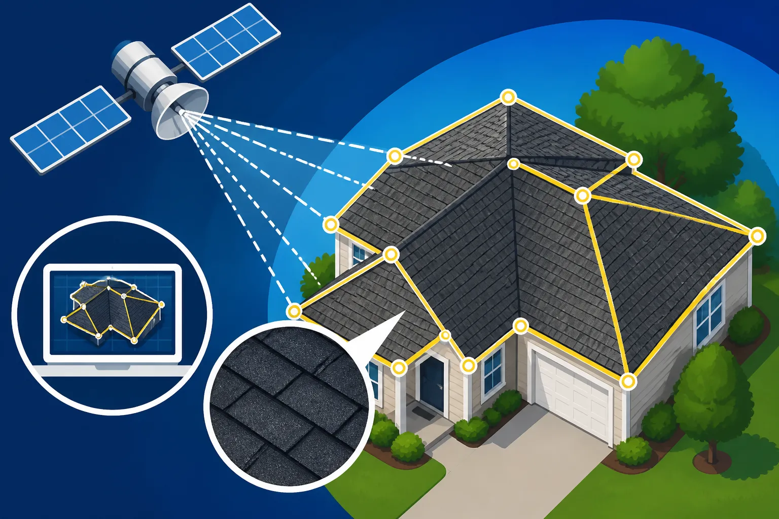
Enter the age of satellite imagery and advanced aerial measurements. What started as simple satellite maps has evolved into sophisticated platforms capable of generating highly detailed, three-dimensional models of your roof. This technology has revolutionized how roofing contractors approach estimates and material ordering. Instead of relying solely on on-site measurements, which can be prone to human error and weather delays, roofers can now access incredibly precise data from the comfort of their office.
This shift isn't just about convenience; it's about elevating the entire roofing experience. It means you can often get a preliminary estimate much faster, sometimes even before a contractor sets foot on your property for an in-person consultation. Companies specializing in these measurements, like EagleView or RoofScope, use high-resolution aerial imagery combined with advanced software algorithms to extract every crucial dimension of your roof, down to the last square foot. It’s essentially a digital blueprint, offering a level of detail that was previously unimaginable without extensive manual labor.
What is a Roofing Square
Before diving deeper into satellite measurements, it's essential to understand a fundamental unit in roofing: the "square." In roofing terms, a "square" is a unit of area equivalent to 100 square feet. So, if your roof measures 2,000 square feet, you have a 20-square roof. This unit is critical because roofing materials, especially shingles, are typically sold and priced by the square.
When you receive an estimate for your new asphalt shingle roof, you'll often see the cost broken down per square. This is why accurate measurement, whether traditional or satellite-based, is so incredibly important. Knowing "What Is a Roofing Square" helps you understand the scale of your project and compare bids more effectively. If a contractor's estimate seems off, it could be due to an incorrect calculation of squares. Satellite measurements aim to standardize this calculation, ensuring everyone is working with the same, precise numbers. Without this foundation, estimating the total material cost for your project would be like trying to bake a cake without knowing the size of your pan—it's just not going to work out right.
How Satellite Roof Measurement Works
The magic behind satellite roof measurement isn't quite as futuristic as it sounds; it's more about clever integration of existing technologies. It's a precise, multi-step process that combines high-resolution imaging with advanced analytical software to deliver incredibly detailed reports.
Data Acquisition: Imagery and Photogrammetry
At the core of satellite roof measurement is imagery. This isn't just your standard Google Maps view; these are high-resolution, often oblique (angled) aerial images captured by specialized aircraft or, increasingly, advanced drone technology. These images are much clearer and more detailed than what you typically see on public mapping services. They capture your roof from multiple angles, providing a comprehensive visual record.
Once these images are captured, the process of photogrammetry begins. This fancy word essentially means using photographs to make precise measurements. Sophisticated software analyzes these overlapping images, triangulating points on your roof from different perspectives to create a highly accurate, three-dimensional model. Think of it like how your eyes perceive depth: by seeing an object from two slightly different angles, your brain can calculate its position in 3D space. The software does this on a much grander scale, mapping out every ridge, valley, hip, and eave of your roof with astonishing precision. This initial data acquisition is crucial for the accuracy of the entire report, as it forms the visual foundation for all subsequent calculations.
Advanced Software and AI Processing
After the raw imagery data is collected and processed through photogrammetry, it's fed into powerful, proprietary software systems. This is where artificial intelligence (AI) and machine learning algorithms come into play. These systems are trained on vast datasets of roof images, allowing them to automatically identify and distinguish various roof features that a human eye might miss or misinterpret.
The software can precisely delineate the perimeter of each roof plane, identify different angles and pitches, locate all penetrations like skylights, chimneys, and vent pipes, and even detect dormers and intricate architectural details. It calculates the square footage of each plane, the linear feet of ridges, hips, valleys, and eaves, and even potential waste factors. This automated processing is incredibly fast and consistent, reducing the chances of human error that can occur during manual measurements. This blend of high-tech imagery and smart software is what truly sets satellite measurement apart, providing a consistent and reliable data source for "Roof Cost Per Square: What You'll Pay" calculations.
The Anatomy of a Satellite Measurement Report
What you get back from a satellite measurement service is far more than just a single number. These reports are comprehensive documents that typically include several key sections, all designed to give a roofing contractor — and you, the homeowner — a complete understanding of your roof's dimensions.
A standard report will feature:
- High-Resolution Aerial Images: Clear views of your roof from multiple angles, often marked with measurement points.
- 3D Model/Diagram: A visual representation of your roof, sometimes interactive, allowing you to see pitches and dimensions from any perspective.
- Summary Page: An overview of the total roof area in squares (100 sq ft units), total linear feet of ridges, hips, valleys, eaves, and rake edges.
- Detailed Breakdown by Roof Plane: Specific measurements for each individual section of your roof, including its surface area and pitch.
- Waste Factor Calculations: An estimate of the extra material (shingles, underlayment) needed to account for cuts, overlaps, and unforeseen issues. This is a critical component that helps in accurate material ordering and reduces waste.
- Line Item Measurements: Precise linear measurements for items like drip edge, flashing, and ridge cap shingles.
- Roof Penetrations: Locations and dimensions of chimneys, skylights, vents, and other obstructions that require special flashing and cutting.
This level of detail is invaluable for creating an accurate roofing estimate, helping contractors understand the "Asphalt Roof Replacement Cost: Complete Breakdown" without even stepping on a ladder. When you're comparing bids, having a standardized report means you can better understand why one quote might differ from another, as the underlying measurements should be consistent.
Key Benefits of Satellite Roof Measurement for Homeowners and Contractors
The shift to satellite roof measurement isn't just a technological fad; it brings tangible, significant benefits for everyone involved in a roofing project. From saving time to enhancing safety, these modern methods are truly transforming the industry.
Enhanced Accuracy and Consistency
One of the most compelling advantages of satellite roof measurement is the dramatic increase in accuracy and consistency. Human error, while understandable, can lead to costly mistakes in traditional measurement methods. A slight misread of a tape measure, an overlooked dormer, or an incorrectly estimated pitch can throw off an entire material order, leading to either expensive delays waiting for more supplies or excess materials that go to waste.
Satellite systems, by contrast, use precise algorithms and multiple data points from high-resolution imagery to calculate dimensions with exceptional precision, often down to a fraction of an inch. This means that the total square footage, linear measurements for ridges and valleys, and even complex pitch angles are determined consistently, every single time. For a homeowner, this consistency translates directly into more reliable estimates. You can compare bids from different contractors with confidence, knowing that they are all basing their numbers on the same foundational data. This transparency helps when you are trying to understand "How to Read and Compare Roofing Estimates," ensuring you're comparing apples to apples, not just different pricing structures.
Speed and Efficiency in Estimating
Imagine needing multiple quotes for a roof replacement. With traditional methods, you'd have to schedule separate appointments with several contractors, each taking an hour or more to measure your roof. This process can drag on for days or even weeks, especially during peak roofing season. Satellite measurement dramatically speeds things up.
Contractors can often pull a detailed report for your address in minutes, sometimes even during the initial phone call. This rapid access to data allows them to generate accurate preliminary estimates much faster, moving you from inquiry to quotation in a fraction of the time. For homeowners eager to get their project started or those facing urgent repairs, this efficiency is a huge boon. It also allows contractors to process more estimates, ultimately benefiting the homeowner by potentially reducing lead times. Companies like Modernize leverage these rapid measurement tools to connect homeowners with pros who can provide quick, reliable quotes. This accelerated process means you can explore various options, from "3-Tab vs Architectural Shingle Cost Compared" to different ventilation setups, without prolonged waiting periods.
Safety and Reduced On-Site Risk
Roofing is inherently a dangerous job. Falls are a leading cause of injury and fatality in construction, and climbing onto a residential roof, especially a steep or multi-story one, always carries risks. Satellite roof measurement significantly mitigates these dangers by reducing the need for contractors to be on the roof in the initial stages.
While an on-site visit is still crucial for a thorough inspection of the roof deck, flashing, and overall condition, the primary measurement process can be done safely from the ground or even the office. This not only protects the contractor but also prevents potential damage to your property that could occur during multiple site visits. For roofs that are particularly high, steep, or otherwise difficult to access, this technology is a game-changer for safety. It means fewer ladders are needed for preliminary assessments, fewer chances of accidents, and a smoother, safer start to your roofing project.
Limitations and Considerations of Satellite Roof Measurement
While satellite roof measurement offers incredible advantages, it's not a silver bullet for every roofing scenario. Like any technology, it has its specific limitations that homeowners and contractors need to be aware of. Understanding these can help set realistic expectations and ensure the best approach for your unique project.
Challenges with Complex Roofs and Obstructions
For most standard residential roofs with clear sightlines, satellite measurement is remarkably accurate. However, highly complex roofs can sometimes pose a challenge. A roof with an unusually intricate design, numerous steep pitches changing abruptly, or an abundance of dormers, turrets, and cupolas might require a closer look. While the software is advanced, very subtle details or extreme architectural variations could occasionally be missed or misinterpreted, leading to slight inaccuracies.
Furthermore, physical obstructions can interfere with the clarity of the imagery. Dense tree cover overhanging large sections of your roof is a prime example. If branches completely obscure parts of the roof, the aerial imagery might not be able to capture the necessary data points accurately. Similarly, large solar panel installations, rooftop patios, or extensive mechanical equipment could block the view of the underlying roof structure. In these instances, a contractor might need to supplement the satellite report with some on-site measurements or a more detailed manual inspection to ensure every element is accounted for. This isn't a failure of the technology, but rather a recognition of its boundaries when facing extremely challenging visual conditions.
Weather and Imagery Quality Factors
The quality of a satellite measurement report is directly tied to the quality of the aerial imagery it's based on. And what affects aerial imagery the most? The weather, of course! While the underlying data might be sourced from various times of the year, recent storm damage might not be visible in older imagery, for example.
Cloud cover can obscure the roof entirely, preventing clear image capture. Heavy snow cover, while beautiful, completely hides the true dimensions and features of your roof, making accurate measurement impossible until it melts. Even shadows cast by tall trees or adjacent buildings at certain times of day can create dark spots that the software struggles to interpret correctly. Furthermore, if the available imagery for your specific property is older or of lower resolution for any reason, the resulting measurements might be less precise than those taken from more current, high-definition captures. This is why sometimes a contractor might need to order a fresh report or conduct an "In-Person vs Satellite Roof Estimates" comparison to verify the details. Ensuring the imagery is clear and current is vital for the most reliable outcome.
The Importance of a Human Touch
Despite the incredible advancements in AI and photogrammetry, satellite roof measurement is best utilized as a powerful tool, not a complete replacement for human expertise. A detailed satellite report provides the raw data – the precise measurements – but it doesn't tell the whole story of your roof's health.
A human contractor brings invaluable experience to the table. They can physically inspect the condition of your existing shingles, look for signs of rot or damage to the underlying roof decking, check the integrity of flashing around chimneys and vents, and assess your attic's ventilation system. They can spot subtle issues like "Nail Pops: Why They Happen" or signs of "Granule Loss: Should You Worry" that aerial photos simply can't reveal. Furthermore, a good contractor will discuss your specific needs, aesthetic preferences, budget, and local building codes, which no algorithm can do. They can also explain the nuances of a "Roofing Warranty: Workmanship vs Manufacturer." The satellite report provides the quantitative data, but the qualitative assessment and personalized recommendations still require the seasoned eye and communicative skills of a reputable professional. Combining both methods often yields the most comprehensive and accurate assessment for your roofing project.
What Information a Satellite Report Provides for Your Asphalt Roof Project
When you receive a satellite roof measurement report, you're not just getting a pretty picture; you're getting a treasure trove of data that directly impacts every aspect of your asphalt roofing project. This detailed information is crucial for accurate budgeting, precise material ordering, and understanding the scope of work.
Comprehensive Material Take-Offs
One of the most significant benefits of a satellite report is its ability to generate comprehensive material take-offs. This means the report doesn't just give you the total square footage of your roof; it breaks down exactly how much of each component you'll need. This includes:
- Shingles: The total number of "squares" required, with an added waste factor (typically 10-15%) to account for cuts, trimming, and unexpected damage during installation. This helps ensure that your contractor orders the correct amount, preventing costly delays if they run short or excessive waste if too much is ordered.
- Underlayment: Whether you're opting for traditional felt or modern synthetic underlayment, the report will provide the precise square footage needed to cover your roof deck. This is critical for protecting your home from moisture, as explained in "Underlayment Explained: Synthetic vs Felt."
- Starter Shingles: Special shingles laid along the eaves and rake edges to provide a secure, straight edge for the first course of main shingles. The report will specify the linear feet required.
- Ridge Cap Shingles: These are thicker, often pre-formed shingles used to cover the peaks (ridges and hips) of your roof. The report will detail the linear footage for these as well.
- Ice and Water Shield: For colder climates or specific vulnerable areas, this self-adhering membrane is vital. The report will show the linear footage needed for eaves, valleys, and around penetrations, aligning with local building codes.
With this level of detail, contractors can create a highly accurate "Roofing Material Cost vs Labor Cost" breakdown, ensuring your budget is realistic from the start.
Detailed Dimensions and Pitch Analysis
Beyond just material quantities, satellite reports provide exact dimensional measurements for every part of your roof. This isn't just a total number; it’s a breakdown of each individual roof plane's length, width, and area. This granular detail is incredibly useful for installers to plan their work, determine shingle layout, and make precise cuts.
Perhaps even more critical is the pitch analysis. Roof pitch, or slope, is measured as the ratio of vertical rise to horizontal run (e.g., a 6/12 pitch means the roof rises 6 inches for every 12 inches of horizontal run). The pitch directly impacts material use, labor complexity, and safety. Steeper roofs, for instance, are harder and more dangerous to work on, often incurring a "Steep Roof Cost Premium" due to increased labor hours, specialized equipment, and safety measures. A satellite report will detail the pitch for each distinct roof plane, providing contractors with the necessary information to accurately bid the labor portion of the job. This precision ensures that estimates account for the specific challenges and requirements of your roof's design, avoiding surprises down the line.
Accessory Measurements and Waste Factors
A roof is more than just shingles; it's a complete system with various accessories that ensure its long-term performance and protection. Satellite reports account for these crucial elements as well.
- Drip Edge: This metal flashing installed along the eaves and rake edges helps direct water off the roof and away from the fascia, preventing water damage. The report will provide the linear footage needed.
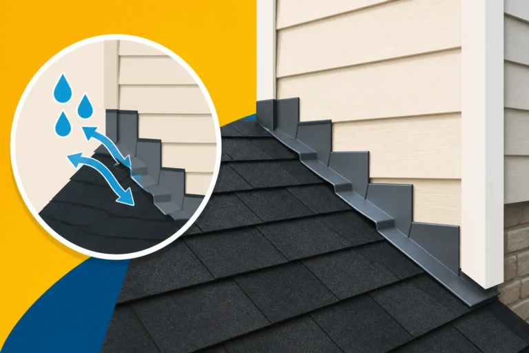
- Flashing: Around chimneys, skylights, vent pipes, and wall intersections, flashing is critical for preventing leaks. The report will typically provide linear measurements for general flashing needs and note the presence of penetrations that require specific flashing solutions. For example, "Chimney Flashing Explained" highlights how these areas need precise measurements.
- Vents: The type and number of vents (ridge vents, static vents, or powered vents) needed for proper attic ventilation can be influenced by the roof's dimensions. While the report may not specify the type of vent, it provides the lineal feet of ridge where a ridge vent might be installed, or the surface area that needs to be ventilated, guiding the contractor in their recommendations.
- Waste Factor: This is an often-overlooked but essential part of any roofing estimate. Shingles need to be cut to fit edges, hips, and valleys, and some will inevitably be damaged or have manufacturing defects. A waste factor, usually between 10-15% of the total material, is added to ensure there's enough material on hand. Satellite reports calculate this based on roof complexity, further refining the accuracy of your "How Much Does an Asphalt Shingle Roof Cost" estimate.
By providing these detailed accessory measurements and factoring in potential waste, satellite reports enable contractors to create incredibly precise material orders, minimizing both material shortages and costly overages.
Integrating Satellite Data into Your Roofing Project
Understanding what satellite roof measurement is and how it works is just the first step. The real value comes from effectively integrating this data into your decision-making process for your asphalt roofing project. This technology empowers you as a homeowner and streamlines operations for contractors.
Streamlining the Estimating and Quoting Process
For roofing contractors, satellite measurement services dramatically streamline the initial phase of any project: creating an estimate. Instead of dispatching a crew to measure every potential job, they can now quickly pull a comprehensive report for almost any residential address. This means:
- Faster Response Times: You submit an inquiry, and within hours (or even minutes), the contractor has the core data needed to generate a preliminary quote. This is a huge benefit, especially when you're dealing with storm damage or an aging roof that needs immediate attention.
- Improved Bid Accuracy: With precise, standardized measurements, contractors can formulate bids with much greater confidence, reducing the guesswork and "padding" that sometimes gets built into traditional estimates to cover potential measurement errors. This can lead to more competitive and fair pricing for you.
- Efficient Resource Allocation: Contractors can save time and labor costs by reducing the need for multiple on-site measurement visits. This efficiency can translate into a smoother workflow and potentially faster project scheduling. If you're looking for "How to Get Multiple Roofing Estimates Fast", this technology is a key enabler. Many forward-thinking contractors are already leveraging these tools.
Validating Estimates and Comparing Bids
For homeowners, a satellite roof measurement report is a powerful tool for transparency and validation. When you receive multiple quotes for your new roof, you can use a consistent measurement report to compare them effectively.
Here's how it helps:
- Leveling the Playing Field: If every contractor bases their bid on the same, accurate satellite measurement report, you can be confident that any differences in price are due to varying labor rates, material quality (e.g., GAF Timberline HDZ Roof Cost Installed vs. Owens Corning Duration Roof Cost Installed), or profit margins, rather than discrepancies in basic measurements. This helps you focus on value, not just the lowest number.
- Identifying Discrepancies: If one contractor provides a significantly different "Roof Cost Per Square" or total squares from what the satellite report indicates, you have a clear basis to ask questions. Is their measurement different? Are they using a different waste factor? This empowers you to engage in a more informed discussion.
- Understanding Scope: The detailed breakdown in the report (linear feet of ridges, valleys, eaves, number of penetrations) allows you to clearly see what should be included in the estimate, helping you to understand "What a Roofing Estimate Should Include" beyond just the total price.
Partnering with Tech-Forward Contractors
When you're searching for "How to Choose a Roofing Contractor", consider looking for companies that embrace modern technology, especially satellite measurement. These contractors are often more efficient, transparent, and precise in their operations.
- Evidence of Professionalism: A contractor who uses these tools demonstrates a commitment to accuracy and efficiency. It suggests they are invested in modern practices and providing you with the best possible service.
- Better Communication: With detailed reports, contractors can walk you through your roof's specifics with visual aids, making it easier for you to understand the scope of work, material quantities, and why certain costs apply.
- Fewer Surprises: By minimizing measurement errors upfront, tech-forward contractors are less likely to encounter unexpected material shortages or scope creep during the project, leading to a smoother experience for everyone.
Platforms like Modernize often connect homeowners with roofing contractors who are equipped with the latest technology, including satellite measurement capabilities. This ensures you're engaging with professionals who can offer the benefits of modern efficiency and accuracy right from your initial consultation, simplifying your "Roof Replacement Payment Plans" and budget preparations.
Maximizing the Value of Your Satellite Measurement
A satellite measurement report is a powerful asset, but like any tool, its effectiveness depends on how you use it. For homeowners, understanding how to leverage this data can lead to a more informed decision, a smoother project, and ultimately, a better roof.
Reviewing Your Report for Clarity and Detail
Once you receive a satellite roof measurement report, take the time to actually review it. Don't just glance at the total square footage. Look for the following:
- Visual Confirmation: Does the aerial imagery accurately represent your home and roof? Check for any obvious discrepancies or areas that might be obscured by trees or other obstructions in the images provided. While the system is excellent, sometimes a very old image might not reflect recent landscape changes.
- Breakdown Consistency: Does the report break down measurements clearly by roof plane, indicating pitches and linear feet for all key components? Look for a detailed "How a Roofing Estimate Is Calculated" section within the report or the contractor's accompanying bid.
- Penetrations and Features: Ensure all features on your roof, such as chimneys, skylights, exhaust vents, and attic fans, are clearly marked and measured. These areas require special attention during installation and often involve specific flashing details, so their accurate inclusion is vital.
- Waste Factor: Understand the waste factor applied. While 10-15% is common for asphalt shingles, very complex roofs might warrant a slightly higher percentage, while simpler roofs might need less.
If anything in the report looks unclear or raises questions, don't hesitate to ask your roofing contractor for clarification. A good professional will be happy to walk you through it.
Discussing the Report with Your Contractor
The satellite report should be a starting point for a deeper conversation with your chosen contractor. It provides the objective data, but their expertise adds context and solutions.
- Material Selection: Use the report's dimensions to discuss specific shingle options, such as "Architectural Shingle Roof Cost" versus more basic 3-tab shingles, and how different choices might impact the overall project cost and aesthetic.
- Ventilation Strategy: The report will identify ridge lines and roof planes. This is an excellent opportunity to discuss optimal attic ventilation solutions, such as whether a continuous ridge vent or traditional box vents would be best for your home, and how "How Roof Ventilation Works" can impact your roof's longevity.
- Addressing Complexities: If your roof has complex areas or noticeable obstructions (like a heavily treed yard), discuss how the contractor plans to manage these. Will they supplement the satellite data with targeted manual measurements? How will they ensure precise flashing around challenging areas?
- Warranty Implications: A detailed report helps ensure the installation adheres to manufacturer specifications, which is crucial for maintaining your shingle warranty. Ask your contractor about their installation practices and how they ensure compliance with the specific requirements of brands like GAF, Owens Corning, or CertainTeed.
This collaborative approach, using the satellite data as a shared reference, ensures that both you and your contractor are on the same page, leading to a more successful project outcome.
Long-Term Value and Documentation
Beyond the immediate project, the satellite measurement report can offer long-term value as a piece of property documentation.
- Future Reference: Keep a copy of your report. If you ever need to perform repairs, add solar panels, or even sell your home, having precise measurements readily available can be incredibly useful. It can save time and money on future assessments.
- Insurance Claims: In the unfortunate event of storm damage, a detailed roof measurement report can serve as valuable baseline documentation for your insurance claim. It clearly defines the pre-damage dimensions, which can help streamline the claims process and ensure you receive a fair payout. Understanding "Does Insurance Cover Roof Replacement" often starts with accurate documentation.
- Home Value: A well-documented, professionally installed roof using precise measurements can subtly contribute to your home's perceived value. It speaks to a level of care and professionalism in maintenance and upgrades.
By treating the satellite measurement report as a valuable piece of information, rather than just a stepping stone to an estimate, you can unlock its full potential to benefit your roofing project, both now and in the future.
Disclaimer
Please remember that while this guide provides extensive information about asphalt roofing, it is intended for educational purposes only. Always consult with a qualified, licensed, and insured roofing professional for specific advice regarding your home's roof. Local building codes and environmental factors can vary greatly, and only a professional can provide an accurate assessment and recommendations tailored to your unique situation.